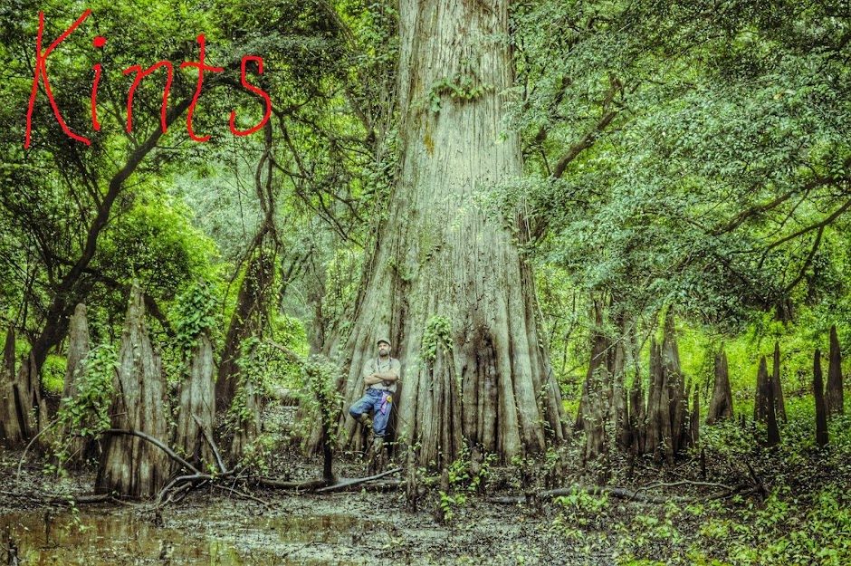
Adventures in Faith-based Ornithology: A Quest for the Ivory-billed Woodpecker in South Mississippi
"...the ornithologists still had serious doubts. Sutton finally put it directly: 'Mr. Spencer, you're sure the bird you're telling us about isn't the big pileated woodpecker?'
"Spencer exploded. 'Man alive! These birds I'm tellin' you all about is kints!' he shouted in their faces. 'Why, the pileated woodpecker's just a little bird about as big as that.' He held his fingers a few inches apart. 'A kint's as big as that!' he said, holding his arms wide... 'Why, man, I've known kints all my life. My pappy showed 'em to me when I was just a kid. I see 'em every fall when I go deer huntin' down aroun' my place on the Tinsaw. They're big birds, I tell you, big and black and white; and they fly through the woods like pintail ducks!'
"After Spencer's outburst, the members of the team were all believers -- not just because of his vehemence, but because his description was so accurate. Ivory-bills do not have the typical bounding flight of the pileated woodpecker. They generally fly away high and straight, with stiff flight feathers, looking very much like a pintail, and their call is a distinctive nasal kent, kent, kent -- very similar to the local name Spencer used, kint. Sutton and the others couldn't wait to get to the bayou and start searching.
"As it turned out, that was not an easy proposition..." --Gallagher, Tim. The Grail Bird: Hot on the Trail of the Ivory-billed Woodpecker, pp. 10-11: "Of People and Peckerwoods."
Our friend Mark updated the Project Coyote site this week with an image-heavy important post discussing the nuances of woodpecker scaling. While the focus is on the impressive evidence discovered in their search area in Louisiana, the information is of tremendous relevance to searchers elsewhere, not least to us here in our own area of focus, the Pascagoula River Basin of Mississippi.
Click on the link here, or on the Project Coyote link to the right on this page.
My brother Brian and I returned to the Stronghold, in the north end of the Pascagoula WMA, to see how the area was faring as autumn laid hold. We made a wide, leisurely survey, straying often from the old forest road; the intricate network of sloughs leading from Hutson Lake in the north, to Hollow Man Lake and Elephant Man Swamp in the south, are largely high and dry, thanks to a persistent drought.
We started before sunrise. Silence lay heavy on the darkling woods until well after, the only sounds the tramp of our boots on dry leaves. Later, woodpecker activity was very high, especially mid-morning. The yellow-bellied sapsuckers have taken up their winter residence in the bottomland and swamp forest. The cool dawn gave way to a very pleasant, clear day; temperatures have been consistently well above average for this time of year.
Only once, while working a complex of mostly dry sloughs near Hollow Man Lake, did we hear what sounded like kent-calls, at around 9:15 a.m. They sounded much like blue jays, only softer; but following the calls south to the lakeshore, we only saw a pair of pileated woodpeckers, which flew off to the swamp forest on the opposite side. The kent-like calls we heard could have been a white-breasted nuthatch, as the species winters here; but the calls were made in the same general area I heard kent-like calls this past April, when I also had a very problematic sighting, and within a few hundred yards of a large sweet gum with extensive, dramatic bark scaling.
Near the southeastern terminus of the forest road, at Elephant Man Swamp, we turned south into the bottomland, then bore eastward, exploring one of the few parts of this sector we had not visited. Like much of the bottomland forest in the Stronghold, it was middle-aged oak-gum, with numerous very large dominant and superdominant individuals.
Predawn gloom. Photo: Brian Carlisle.
Photo: Brian Carlisle.
At the south end of one of the large fields in the midst of the bottomland. Photo: Brian Carlisle.
Difficult to see in this photo, but there is extensive scaling along the top branches of this live sweet gum, though without a closer view it is impossible to classify as anything other than general woodpecker work.
My sharp-eyed brother spotted this. The silhouetted bird in the center of the photo is a ruby-crowned kinglet that had gotten caught in the web of a golden silk orb weaver spider, some 15 feet or more above the trail. We tossed dead branches at the web for several minutes, until finally Brian hit it, and the kinglet zoomed off into the woods.
This large woodpecker cavity in a water oak is easily seen from the main trail. Photo: Brian Carlisle.
At the south fork of the forest road. To the right, Hollow Man Lake; left, Elephant Man Swamp. Photo: Brian Carlisle.
The numerous sloughs in the Stronghold normally greatly restrict movement in the area.
We breakfasted on candy bars and bacon jerky by this Nuttall's Oak.
Photo: Brian Carlisle.
Photo: Brian Carlisle.
Photo: Brian Carlisle.
Photo: Brian Carlisle.
Photo: Brian Carlisle.
Extensive, dramatic scaling on the sweet gum I found on an eventful day back in April of this year.
I believe the tree may be dying.
Photo: Brian Carlisle.
I use a "bully horn," really the horn of a water buffalo, to try and mimic woodpecker tapping, including Campephilus-style single knocks and double knocks. Photo: Brian Carlisle.
Rapping on this Nuttall's Oak today only succeeded in luring a number of squirrels. Photo: Brian Carlisle.
Brian had brought his small john-boat, which we used after our hike to survey Hutson Lake.
Photo: Brian Carlisle.
Bright green lichen distinctly stands out from the gray Spanish moss atop this baldcypress.
There were hunters in the same area we were in that day, though we did not see them personally -- only their spent shotgun shells, which we collected on our return hike. We will have to wear blaze orange on all our forays into old Ivorybill country for the next few months.
On October 20, my brother Brian Carlisle and I had the pleasure of attending a meeting of the Pascagoula River Basin Alliance (PRBA) at the University of Southern Mississippi's Gulf Coast Reasearch Laboratory, in Ocean Springs, Mississippi. The PRBA's members are an eclectic group representing industry, state government, academia, and concerned citizens groups, as well as the Nature Conservancy. We were pleased and honored to be invited to attend, and to give a short presentation regarding our search for evidence of the Ivory-billed Woodpecker in the lands of the Basin. There we made some new friends, and learned about the ongoing efforts of the PRBA as stewards of the Pascagoula River Basin, which I like to call Mississippi's Last Best Place. Of tremendous importance to the wildlife of the region, we learned that the Nature Conservancy recently completed transfer of their first Forest Legacy Acquisition Project to the Mississippi Forestry Commission -- to become the 2,100 acre Leaf River State Forest, linking vital habitats along the Pascagoula River and its tributary, the Leaf River.
Now for a bit of housekeeping: repairs to my desktop computer should be completed soon, so I will be able to more easily update the blog as necessary at better quality than I am currently able, beginning with our last visit to the Stronghold on October 28.
Thanks to those of you still following our efforts here in old Ivorybill country. I look forward to the fall/winter/spring search season at hand, and to sharing our finds with you on this site. We still walk these old woods with hearts and minds open to the great Possibility.
In the dawn hours of Friday, September 23, my brother Brian Carlisle and I kayaked up the Pascagoula River to its headwaters, where the Leaf and Chickasawhay Rivers meet. It was a place I had longed to visit. The area is protected by the Nature Conservancy, in the form of the Charles M. Deaton Preserve, named after one of the founders of the Conservancy's Mississippi chapter. We kayaked upstream from the boat landing near the bridge at Merrill to a sandbar on the Chickasawhay side. A couple of minutes of scouting yielded the tail end of a trail, which we followed west-northwest, paralleling the Leaf. The habitat is young to middle-age hardwood forest, dotted with baldcypress, and occasional sycamores of considerable size. Many songbirds made their presence known, but I did not feel the woods there held much potential in terms of ivorybills. We explored for a half hour or so, then made our way back to the kayaks.
After driving around for a while along the roads to the east of the River, we found ourselves at the launch site we had used in 2015 to reach the heavily forested lands around Booger Hole Slough, possibly (to my knowledge) the northernmost lake in the WMA. A large flock of turkeys greeted us from the big sandbar on the opposite bank. We put in, kayaking upstream much further than we had last year, until we reached a very large, densely forested island in the midst of the Pascagoula River. Since it is not named on Google Earth, I have called it Pree Island, after nearby Pree Eddy. It is managed by the Nature Conservancy. The forest there is fully mature bottomland hardwood, with a nice mix of oak, sweet gum, and sycamore, with baldcypress in the lower areas and near the edges. Not much woodpecker work evident, though as with any patch of forest here this time of year it is difficult to spot due to the leaves. After exploring a clear, cool stream that divides the island from the mainland to the east, we launched back into the Pascagoula. Exhausted from kayaking upstream and hiking Pree Island, we allowed the River to carry us downstream.
Brian stands at the cofluence of the Leaf and Chickasawhay Rivers, where the Pascagoula River is born. The Pascagoula is the largest free-flowing river (by volume) in the lower 48 States.
(Photo: Brian Carlisle.)
Grove of black willows near the Chickasawhay River.
Brian along the bank on the Leaf River side.
Downstream view, heading back to the landing.
We floated our kayaks along the shoreline for a good part of the way upriver to Pree Island. The water level is very low. Burn bans are in place for most of the counties of south Mississippi.
This shallow stream is currently all that separates Pree Island from the east bank. During seasonal flooding, it will become a broad arm of the Pascagoula.
Amidst the sweet gums and saw palmetto on Pree Island.
NOTE: I am currently working from a smallish, borrowed laptop computer until my desktop PC is repaired. Until then, blog entries will tend to be brief, like this one.
My computer hard drive crashed this past week, so my posts here will be limited, at least for the near future. I made a very brief trip to the Stronghold, in the northern Pascagoula River Swamp, on September 10, but had no Ivorybill encounters. I will hopefully return to the Pascagoula River Basin before October.
I've been late getting back out into the field, due to a hectic schedule, truck maintenance, and rather disagreeable weather (the usual heat and humidity this time of year, coupled with an unusually wet August). Hunting season begins in a couple of months, though, meaning there will be others carrying guns (and bringing their dogs) in the swamps and bottomlands with me.
Despite a slight easing of temperatures this week, there continues to be no really good day to search for the Ivorybill this month. Nevertheless, this past Sunday I headed out again, alone, bound once more for remote John Goff Slough in the south end of the Pascagoula River Swamp. I brought my kayak, fearing the rains had made parts of my route impassable; but I found the WMA road, under water for months earlier this year, still lay dry and open.
The clear, still dawn came at 6:21. A few minutes later, I was headed north on the trail through the old bottomland forest. The birds were quiet for much of the early morning; strangely, they only began really vocalizing later in the morning, after 10 a.m. Woodpeckers were conspicuously absent throughout my hike, with only 1 pileated and a couple of red-bellied woodpeckers showing themselves the entire day. Biting insects were a bit worrisome, unlike my prior visit. Luckily, much of my walk was in deep shade, but temperatures were likely never over 90 degrees (Fahrenheit). Not exactly comfortable, but pretty good for a Mississippi swamp in August, and made more bearable by occasional breezes.
I retraced the return hike my brother and I took on our prior visit to the Slough, and continued along the trail north. It brushed the northern tip of the giant old oxbow and bent east, following the course of the inner shoreline. I generally avoided the trail itself, which was thick with knee-high grasses and weeds; instead I held to the shade of the nearby swamp forest, where the going was generally easier along the narrow band of dry ground between the swamp and the forest edge. Eventually the trail played out, and I was forced to make my way through some difficult terrain, shin-deep flooded mixed swamp/bottomland forest, until I began seeing some familiar trees and, ultimately, the trail that would take me back to my truck. Bottomland tree species I observed included sweet gum, spruce pine, green ash (several individuals), water oak, willow oak, Nuttall's oak, shagbark hickory, and beech; the swamp forest was comprised, as ever, by baldcypress and tupelo.
Swamp forest about a half mile from the trailhead.
Typical views from the first couple of miles from the trailhead.
I was drawn to this dark creek by the sound of large animal activity on the near bank.
I decided to try to get a little closer.
He was only a small hog, though I could see his tusks. I was able to get quite close to him. (I would later cross paths with a sow and piglets, without incident.)
Much of the forest floor in the area is kept clear by frequent flooding from the River.
I was a bit surprised to find occasional loblolly pines in this area.
I was constantly drawn off the trail by the tranquil, almost eerie beauty of the swamp forest that has overtaken the old oxbow.
The golden silk orb weavers are lords of their kind here, but they are not unfriendly. Well, maybe a little.
The worst are the smaller species, whose webs I am often unaware of until they are stretched across my face or arms.
Polyphemus.
I felt the relict baldcypress watched me warily, though the water prevented my close approach.
I was as always excited to discover another Survivor. I am in awe of them, and their presence here brings me joy: for their kind survived a different holocaust -- the destructive logging operations of the 20th Century. It is ironic that they were spared due to what were seen as imperfections. Now these towering monoliths are living links to preindustrial -- and, in some cases, pre-Columbian -- North America. I am heartened that they still stand here, despite the petty machinations of Man.
My furthest point that day.
Shagbark hickory near the south end of John Goff Slough.
Moth has a bad day.
I ended the 6.3-mile hike near noon. While had no Ivorybill encounters and found no evidence suggestive of Ivorybill-type bark scaling, I would very much like to kayak John Goff Slough.