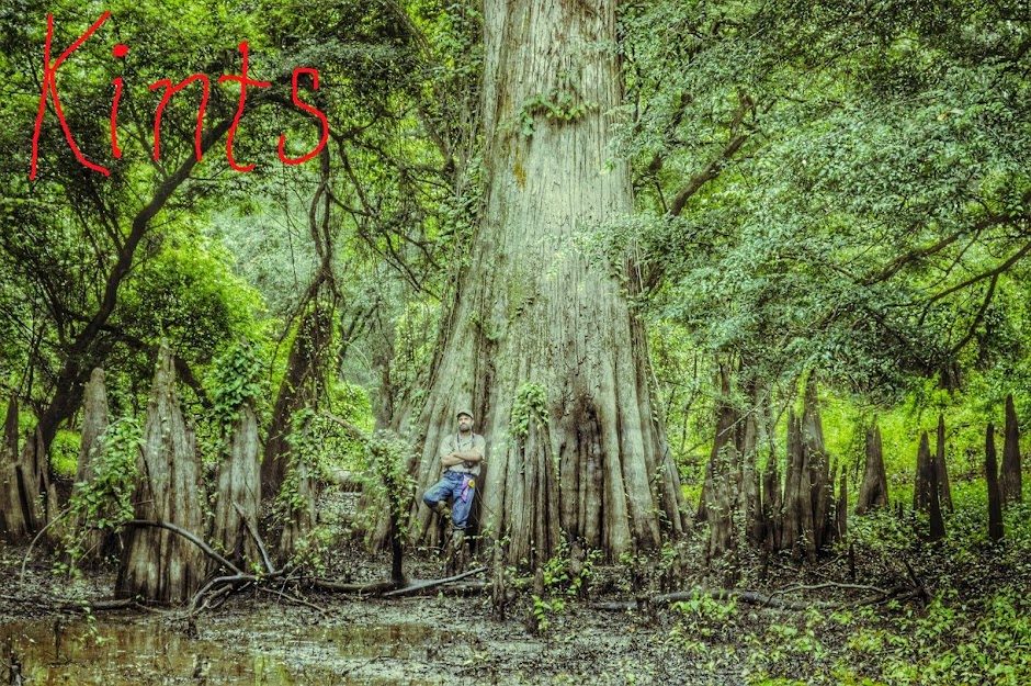
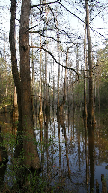
I have been absent over-long from the Pascagoula Swamp, due largely to obligations to my day job and the demands brought by Spring to small-time gardeners like myself. I managed to get back afield for half a day, though, and headed down to the Hutson Lake sector of the Pascagoula WMA, an area I call the Stronghold.
Much of our efforts in the Pascagoula River Basin have been exploration -- surveying remote pockets of bottomland and swamp forest habitat. I doubt that we will ever visit every corner of the Basin, but as the number of places new to us decreases, the most promising ones become fixed as sites for longer-term survey and surveillance. The Stronghold is such a place.
Deer were moving near the trailhead in the pre-dawn gloom. I was far along the old logging trail I call Hollow Man Road at sunrise (around 6:30 A.M., Central Standard Time), bound for the network of sloughs where I'd had an intruiging but inconclusive experience almost a year ago. Temperatures were in the upper 60's (Fahrenheit), with a nice breeze. Early cloud cover cleared out by mid-morning. Bird activity was very high, though I do not think the Spring warblers have yet arrived; and of woodpeckers, I saw or heard all the usual suspects: downy, red-bellied, red-headed, and pileated woodpeckers, as well as flickers. I believe the yellow-bellied sapsuckers have left these parts, though, and there was no sign of hairy woodpeckers, which are in any case uncommon to rare in the Basin.
A great egret and a pair of catcalling kingfishers greeted me as I settled into a nook at the base of an oak overlooking a sun-dappled slough. It was 8 A.M., and I planned on a 2-hour watch.
You can follow some of my progress along Hollow Man Road in the next four videos:
In April of last year I found a sweet gum that appeared to me to exhibit dramatic woodpecker scaling. I have since concluded, after some correspondence with a forester friend, that lightning likely was the cause, at least initially; though it is possible that some of the scaling was done by woodpeckers, I can not with any degree of certainty attribute it to Ivorybills. The sweet gum has died.
I was treated to a nice show after only a few minutes of sitting very still: a pair of otters.
Much of our efforts in the Pascagoula River Basin have been exploration -- surveying remote pockets of bottomland and swamp forest habitat. I doubt that we will ever visit every corner of the Basin, but as the number of places new to us decreases, the most promising ones become fixed as sites for longer-term survey and surveillance. The Stronghold is such a place.
Deer were moving near the trailhead in the pre-dawn gloom. I was far along the old logging trail I call Hollow Man Road at sunrise (around 6:30 A.M., Central Standard Time), bound for the network of sloughs where I'd had an intruiging but inconclusive experience almost a year ago. Temperatures were in the upper 60's (Fahrenheit), with a nice breeze. Early cloud cover cleared out by mid-morning. Bird activity was very high, though I do not think the Spring warblers have yet arrived; and of woodpeckers, I saw or heard all the usual suspects: downy, red-bellied, red-headed, and pileated woodpeckers, as well as flickers. I believe the yellow-bellied sapsuckers have left these parts, though, and there was no sign of hairy woodpeckers, which are in any case uncommon to rare in the Basin.
A great egret and a pair of catcalling kingfishers greeted me as I settled into a nook at the base of an oak overlooking a sun-dappled slough. It was 8 A.M., and I planned on a 2-hour watch.
You can follow some of my progress along Hollow Man Road in the next four videos:
In April of last year I found a sweet gum that appeared to me to exhibit dramatic woodpecker scaling. I have since concluded, after some correspondence with a forester friend, that lightning likely was the cause, at least initially; though it is possible that some of the scaling was done by woodpeckers, I can not with any degree of certainty attribute it to Ivorybills. The sweet gum has died.
Excavation into the still-hard sapwood.
Large sections of bark are beginning to separate from the sapwood, although the bark still retains much of its strength.
Superdominant red oak near the trail. Spruce pine in foreground.
New and impressive beaver dam.
Observation post for my two-hour watch.
Moon over the Stronghold.
I was treated to a nice show after only a few minutes of sitting very still: a pair of otters.
They didn't spend much time watching me, and went on about their business.
A barred owl came along not long after the otters disappeared. He spied me soon enough.
I guess it decided I was up to no good.
A strong breeze created a brief shower of catkins.
Unlike my still hunt there last year, I heard no kent-like calls or Campephilus-style woodpecker knocks, and had no possible visual IBWO encounter. But on the hike back north I was treated to this:
The swallow-tailed kites have returned to the skies above the Basin.
As well as a feral hog just off the trail, a blackish individual I believe I may have encountered in the area before. The wind shifted as I tried to get a photo, though, and it trotted off into the underbrush.
I hope I can get back to the Stronghold soon for another still hunt like this, while the days are still pleasant, and the forest loud with the conversations of birds.


