"...the ornithologists still had serious doubts. Sutton finally put it directly: 'Mr. Spencer, you're sure the bird you're telling us about isn't the big pileated woodpecker?'

"Spencer exploded. 'Man alive! These birds I'm tellin' you all about is kints!' he shouted in their faces. 'Why, the pileated woodpecker's just a little bird about as big as that.' He held his fingers a few inches apart. 'A kint's as big as that!' he said, holding his arms wide... 'Why, man, I've known kints all my life. My pappy showed 'em to me when I was just a kid. I see 'em every fall when I go deer huntin' down aroun' my place on the Tinsaw. They're big birds, I tell you, big and black and white; and they fly through the woods like pintail ducks!'

"After Spencer's outburst, the members of the team were all believers -- not just because of his vehemence, but because his description was so accurate. Ivory-bills do not have the typical bounding flight of the pileated woodpecker. They generally fly away high and straight, with stiff flight feathers, looking very much like a pintail, and their call is a distinctive nasal kent, kent, kent -- very similar to the local name Spencer used, kint. Sutton and the others couldn't wait to get to the bayou and start searching.

"As it turned out, that was not an easy proposition..." --Gallagher, Tim. The Grail Bird: Hot on the Trail of the Ivory-billed Woodpecker, pp. 10-11: "Of People and Peckerwoods."

Tuesday, October 6, 2015

In Which We Pay a Visit to an Old Friend, and Make a New One: 4 October 2015

Brian and I revisited the Hutson Lake area for an extended hike, with our friend Curtis Holland of Laurel as guest.  We intended to introduce Curtis to the grandfather cypress we call the Ancient of Days, and to hike the long trail I call Hollow Man Road to its namesake, all the while reexamining the area for feeding sign and woodpecker cavities that we might have missed on previous surveys.  I also wanted to revisit the remote southeastern corner of this sector, to attempt to locate yet another titan cypress I had glimpsed from afar during a solo hike back in December of 2014.

I will provide photos and video, with little additional commentary.

Hutson Lake.  The water level is still very low.  (Photo:  Brian Carlisle.)

 Near Hutson Lake.  (Photo:  Brian Carlisle.)

(Photo:  Brian Carlisle.) 

(Photo:  Brian Carlisle.)

Curtis meets the Ancient of Days.

I apologize for the at times screwy video angle.


(Photo:  Brian Carlisle.) 

(Photo:  Brian Carlisle) 

(Photo:  Brian Carlisle.) 

 (Photo:  Brian Carlisle.)

Dry swamp forest to the north of Hutson Lake. 

 (Photo:  Brian Carlisle.)

 (Photo:  Brian Carlisle.)

(Photo:  Brian Carlisle.)

Brian calls this the Butterfly Trunk.  (Photo:  Brian Carlisle.)

Brian discovered a small pool within the dry swamp floor. 

 It was, we discovered, occupied. 


Curtis and I leaving the Gar Pool Swamp.  (Photo:  Brian Carlisle.)

 Curtis and I on Hollow Man Road.  (Photo:  Brian Carlisle.)

(Photo:  Brian Carlisle.)

Not far along Hollow Man Road, eagle-eyed Brian spied a cypress with some heavy bark stripping.  Earlier conversations on the subject with Mark Michaels of Project Coyote lead me to suspect this as the work of squirrels, though I have never seen bark stripping on a cypress as extensive as this.  There were no marks to indicate to me that this was woodpecker-work.


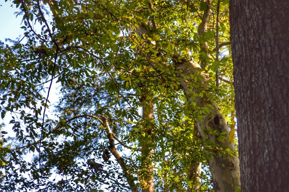
We passed a mature black cherry that had been downed by high winds, and later had to work our way through the canopy of a mature water oak that had uprooted and crashed across the trail.  A mile or two on down Hollow Man Road, Brian again spied a tree with what appeared to be extensive bark stripping, this time on a living oak.  Bringing our binoculars to bear on the subject, we saw this:


What looks to be classic Campephilus-style extensive bark stripping.  Excited, we shed our packs and plunged through the undergrowth to get a closer look.  We soon discovered what was responsible:

 The tree base, nearly destroyed by lightning.  Curtis found long strips of wood lying in the brush 10-15 yards from the tree.

 One can see in this poor quality photo the trail left by the lightning as it coiled up the bole to blast out of the crown.

A large woodpecker cavity already known to us, in a water oak overlooking the trail.

My brother is not one to pass up an area we have not looked at.  Curtis and I rested on a downed tree at the trailside while Brian set off to examine a dry slough nearby.  Presently I heard his bob-white whistle to try and get my attention.  This is what he'd found:


A very large woodpecker cavity in a living cypress.  We imagine it is at least the work of a Pileated Woodpecker.

Shortly thereafter, we paid our respects to Hollow Man himself, whose bed has dried up since my last visit.


We were by that time rather spent, but I wanted to try to find the phantom cypress that had eluded me during my last winter visit, and which I was beginning to think might have been only a figment of my imagination.  We struck out on the trail eastward from Hollow Man, crossing into mixed bottomland forest that quickly gave way to swamp forest, now mostly dry.  I scanned the area, looking for the great tree, but did not see him, until the three of us had turned around to begin the long hike back.  Then, through the trees, I spied him.  Making our way through some difficult terrain along the changeable swamp edges, we finally got a clear view:


The first thing that came out of my mouth, after I'd gotten a good look at him, was:  "Lord God."  I decided immediately that's what I wanted to name him.


(Photo:  Brian Carlisle.)

 As with the other titans we have encountered, Lord God Tree was spared the axe and saw only because he is hollow.  Would that more of his kind had been hollow, too.  (Photo:  Brian Carlisle.)

(Photo:  Brian Carlisle.) 

(Photo:  Brian Carlisle.)


Taking our last leave of the Lord God Tree.

We bid farewell to our new friend, and began the long hike back up Hollow Man Road to Hutson Lake.  Once, about halfway there, a Pileated Woodpecker bulleted across the trail ahead of us, and Curtis let out a small gasp.  "Was that?..."

I knew exactly how he felt.

(For more high-quality photos of our Ivorybill journeys, please visit my brother's Facebook page, called 'The Humble Hiker.')


Friday, October 2, 2015

Madness

Last week, after our last trek in the Pascagoula WMA, Brian and I went for our usual lunch at the Benndale Super Stop before heading home.  While paying for my meal, I noticed a headline on a stack of newspapers; the headline said something about a dam on the Pascagoula River.  I made a mental note to look it up later.

I found out that there is a proposal to dam Big and Little Cedar Creeks, tributaries of the mighty Pascagoula, down in Jackson County, one of Mississippi's three Gulf Coast counties.  Damming the tributaries will create a lake, purportedly to be called Lake George (since much of its backflow will be in George County).  The official reasoning behind the push for the dams is that the "fake" lake will help alleviate the effects of drought on the Pascagoula River, which currently holds the title of longest undammed river by volume in the lower 48 (contiguous) United States.

There is strong pushback from local property owners whose homes would be flooded by this lake, and the Gulf Coast chapter of the Sierra Club has come out publicly as strongly opposed.  As of today, I do not know the status of the proposal; hearings for or against the dam were supposed to be held this week.

My heart breaks for the river.  It is all I can do to control my anger at my species, which yet again seeks to strike a blow at the Pascagoula River and the lands round about.  Only now are its forests beginning to reassert themselves since the destructive logging operations of the last century left it a mournful land of stumps and ghosts.  In my walks among the great trees growing there again, I can feel the presence of those ghosts.  They do not judge.  They do not have to.

What is to become of a species which cannot help but think it can manage Nature better than she can manage herself?


Tuesday, September 29, 2015

Poking Around Booger Hole Slough: 25 September 2015

IBWOH's:  Brian Carlisle, Chris Carlisle.

Summary:  Encouraged by our findings in the Otter Pond area in the far north of the Pascagoula Wildlife Management Area (WMA), my brother Brian and I decided to follow up with a trip to Booger Hole Slough, a small lake a little over a mile (as the crow flies) to the north of Otter Pond, and which effectively marks the northern limit of the WMA.  We were obliged to take a different road into the WMA from the highway, in order to put our kayaks into the Pascagoula River a few hundred yards below what looked to be a channel off the river; we planned to follow the channel inland as far as we could, then strike out overland for Booger Hole Slough, which lay nearby.

The morning dawned fair and cool; the thermometer in Brian's truck read 61 degrees (Fahrenheit).  There were no clouds.  The access road first plunged through young pine plantation on private land, before winding through middle-aged mixed cypress/bottomland hardwood forest in the WMA.  Long, narrow Cochran Dead River, an oxbow being slowly but surely consumed by the forest, lay partially hidden by cypresses and mist and the predawn gloom off to our right.  We arrived at the landing (really just a wide, flat, grassy space along the riverbank) with the dawn.

 Brian readies his camera equipment before we embark.  The wide, flat top of the sandbar opposite marks a higher water line, reflecting this region's current drought conditions.

Downstream view. 

Our upstream route.  Another giant sandbar lies exposed by the low water.

We put in and paddled north.  The water was rather warm to the touch.  Brian soon left me behind, and we maneuvered around half-submerged trees and sandbars looming inches beneath the surface; I nevertheless grounded the Kuhn more than once.  We saw no other signs of humans as we traveled, and heard only the distant growl of a boat motor on Cochran Dead River.

After what seemed an inordinate amount of time, we still had not located the channel that we believed should have materialized off to our left.  We beached upon another sandbar on the River's west bank to have a look round, and found the channel (such as it was) soon enough.

 Killdeer on the west bank.


The mouth of the bone-dry channel. 

Chickadees, warblers, and a downy woodpecker busied themselves among the black willows and sycamores along the channel.

We decided to hike the dry channel bed as far as we could, before striking out into the woods in hopes of hitting either a trail, or Booger Hole Slough itself.  Willow, sycamore, and river birch crowded the channel, with the occasional beech or loblolly pine on higher ridges; wide stretches of briars, often covered by muscadine vines, interrupted the forest beyond.  We saw few large trees of any species.  The trees on either side helped form the channel into a sort of shadowy tunnel.  A pair of wild turkeys took off from their roost, startling me with their heavy wingbeats, and a barred owl glided silently down the tunnel, over my head as I knelt, before veering off into the trees far beyond.


(Photo:  Brian Carlisle.)

Eventually, nearing what we believed to be the end of the channel on a high bank over the River, we veered off overland through a young tupelo swamp forest:

Here, as in the Otter Pond area, the swamp had dried out, leaving a rather open, grassy floor that was easy to navigate.  The trees here are much smaller, though.

The GPS on Brian's phone worked, so we navigated the youngish woods a while, eventually coming to a trail, and Booger Hole Slough.

 (Photo:  Brian Carlisle.)

(Photo:  Brian Carlisle.)


The lake is quite lovely and is surrounded by older mixed bottomland woods and cypress/tupelo swamp forest.  Gray squirrels were abundant.  Red-bellied woodpeckers busied themselves in the trees along the shoreline.  Anhinga, great blue heron, and great egret fished the lake's waters as wood ducks wheeled in their whistling flight overhead.  Brian spied a small flock of white ibis, as well as a couple of Louisiana waterthrush, species that will soon abandon these lands, for a little while.

Farther to the north, the woods begin to fail again, and the cross-country traveller faces rather daunting, nearly impassable swathes of vine-covered blackberry.  We followed the path around the lake, noting the many "POSTED, NO FISHING OR TRESPASSING" signs round about which marked the end of the WMA,  There were a few impressive trees, and some woodpecker sign.

A massive, triple-crowned red oak.

Natural cavity in a large sycamore.

The path led us back to the young tupelo wood, and we knew we'd explored the area as fully as we probably could, or needed to.  We made our way back to the dry channel, to the kayaks, and made the easy return float back down the River to our landing.

The butterflies had awakened while we hiked, and were numerous near the channel mouth.  (Photo:  Brian Carlisle.) 

A hog wallow in the channel's sandy bed. 


Brian strolls the sandbar opposite our landing.

Conclusions:  This parcel, the extreme northern outlier of the Pascagoula Wildlife Management Area, is marked by primarily younger woods, with more mature stands round about Booger Hole Slough itself; as such, I do not believe it worth our time to revisit, as it may be of value to any remaining resident Ivorybills mostly as part of a habitat corridor formed by the River itself, linking the great forests of the Pascagoula River Swamp to the south with similar habitats farther up the River, and eventually with stands along the Leaf River and the enormous DeSoto National Forest to the northwest.  This great corridor formed by the Pascagoula and its tributaries to the vast forests of south Mississippi is one major reason why I believe the area should be a primary focus for the search for evidence of the continued existence of Ivory-billed Woodpeckers.  Habitat fragmentation in other regions may have long ago contributed to the end of elusive, remnant populations of Ivorybills; if the species survived the great deforestation of South Mississippi during the last century (the destructive scope and scale of which we can probably not properly appreciate), they would have found the interconnectedness of the region's forests well-suited to their large home ranges.

So I like to think, and to hope.