
The brutal heat dome over much of the eastern and central United States this month did not spare south Mississippi. Occasional storms, brewed by Gulf moisture, provide brief respites; but it has so far been a cruel summer, leaving me reluctant to venture into the humid swamps and bottomlands. However, my brother Brian and I decided to brave the temperatures for a foray into the far south of the Pascagoula River Swamp, between the River and the Wade-Vancleave Road, to explore an area I had not been able to access since last year: Lice Lake, and beyond it, massive John Goff Slough, an ancient oxbow long since claimed by cypress-tupelo swamp forest, lurking in a difficult-to-access corner of the Pascagoula River Basin like a dark, distant planet of our solar system. I have felt its pull.
We left well before sunrise, but because of the long drive involved from my brother's house, we did not get started until after the dawn. Lice Lake is at the northern terminus of a long Wildlife Management Area (WMA) road, and we took our time driving it, since it was Brian's first visit to the area. We arrived without incident, noting numerous juvenile hawks along the way (I believe they were broad-winged hawks) and a couple of feral hogs. The bottomland forest on this south end of the Pascagoula WMA is what I consider middle-aged, with occasional superdominant water oaks; sweet gum is extremely common here, with many good-sized specimens. I did not notice any scaling of interest on any of the trees during the drive to Lice Lake.

Our goal, as stated above, was to survey remote John Goff Slough. I was not sure how to get to it; the most obvious route was to strike out northeastwards from Lice Lake, cross-country; but we followed a trail from the lake instead, hoping that it would lead us to the slough. Unfortunately, the trail took us east-southeast, following the course of a tea-colored stream named Black Creek on the GPS. We crossed the creek and followed it back upstream through the woods, then struck out across the bottomland. Luckily, we discovered other trails, and after a fairly long hike of 1-2 miles, found ourselves at the southern tip of the ancient oxbow.


John Goff Slough lies to the east and mirrors a sharp bend of the Pascagoula River. Frequent flooding from the River and the Slough has left the bottomland fairly open and easy to navigate, with few thickets and briars. We made our way along the inner curve of the reverse-"C" formed by the lake until nearly noon, when we finally gave in to the heat and decided to make our way back to Brian's truck.

Following are some images of the area, with sparse commentary.


We left well before sunrise, but because of the long drive involved from my brother's house, we did not get started until after the dawn. Lice Lake is at the northern terminus of a long Wildlife Management Area (WMA) road, and we took our time driving it, since it was Brian's first visit to the area. We arrived without incident, noting numerous juvenile hawks along the way (I believe they were broad-winged hawks) and a couple of feral hogs. The bottomland forest on this south end of the Pascagoula WMA is what I consider middle-aged, with occasional superdominant water oaks; sweet gum is extremely common here, with many good-sized specimens. I did not notice any scaling of interest on any of the trees during the drive to Lice Lake.

In the above image, John Goff Slough is the big, reverse-"C" just to the north-east of the blue GPS locator dot.
Our goal, as stated above, was to survey remote John Goff Slough. I was not sure how to get to it; the most obvious route was to strike out northeastwards from Lice Lake, cross-country; but we followed a trail from the lake instead, hoping that it would lead us to the slough. Unfortunately, the trail took us east-southeast, following the course of a tea-colored stream named Black Creek on the GPS. We crossed the creek and followed it back upstream through the woods, then struck out across the bottomland. Luckily, we discovered other trails, and after a fairly long hike of 1-2 miles, found ourselves at the southern tip of the ancient oxbow.


John Goff Slough lies to the east and mirrors a sharp bend of the Pascagoula River. Frequent flooding from the River and the Slough has left the bottomland fairly open and easy to navigate, with few thickets and briars. We made our way along the inner curve of the reverse-"C" formed by the lake until nearly noon, when we finally gave in to the heat and decided to make our way back to Brian's truck.

Following are some images of the area, with sparse commentary.

The WMA road, under water for much (or most) of this past Spring. Photo: Brian Carlisle.

View of the Pascagoula River, not far from the trailhead. Photo: Brian Carlisle.

Not sure what the hell I was doing there. Photo: Brian Carlisle.

Trailhead near Lice Lake. Photo: Brian Carlisle.


We have not been able to identify this wildflower. Photo: Brian Carlisle.

Photo: Brian Carlisle.


Chanterelles. Thanks to Joseph Hosey of Laurel, MS for help in their identification.


It was hot by mid-morning. I stop to cool my hands and arms in the creek.

On the trail to John Goff Slough.


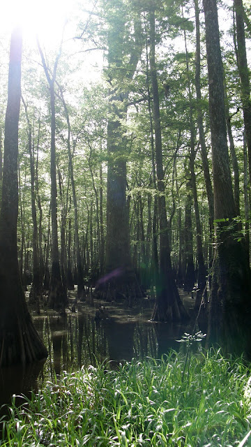
Bottomland forest between the arms of John Goff Slough.


Old water line on a water oak in the bottomland near the slough.

Woodpecker scaling on a dead tree. We noticed no other scaling in the vicinity.


Mast, in the form of shagbark hickory nuts and acorns from a Nutall's oak.

A huge Nutall's oak, in my experience an uncommon species in the Pascagoula Basin.

Photo: Brian Carlisle.

John Goff Slough. Photo: Brian Carlisle.

Photo: Brian Carlisle.

Photo: Brian Carlisle.

Titan, one of two relict baldcypresses we encountered. Photo: Brian Carlisle.

Photo: Brian Carlisle.

Photo: Brian Carlisle.


History.


A second relict baldcypress, which we named Europa.

Bird life was largely muted, including the woodpeckers: pileated and red-bellied woodpeckers called in the distance, but were no-shows and fell silent by midmorning. Aside from a flock of wild turkeys and a circling pair of Mississippi kites, we observed few other birds. With no paved roads or houses nearby, and boat traffic on the River nonexistent, the forest was largely quiet, with only the occasional drone of an aircraft engine humming in the distance.
I hope to return to this southern sector of the Pascagoula River Swamp soon. While the bottomland forest we explored was not quite as mature as in other areas (notably the Hutson Lake area in the north of the WMA, and central Big Swamp), I feel John Goff Slough and its environs is quality habitat, and holds great promise due to its extent and remoteness. We would like to be able to kayak the Slough, but as far as I know that would require portaging our boats some two miles. Further exploration of the area may reveal an opportunity therein. I hope so; the thought of finding more relict baldcypresses excites me almost as much as the thought of finding Ivorybill sign... possibly because both are, to my mind, glimpses of a lost world.

No comments:
Post a Comment