"...the ornithologists still had serious doubts. Sutton finally put it directly: 'Mr. Spencer, you're sure the bird you're telling us about isn't the big pileated woodpecker?'

"Spencer exploded. 'Man alive! These birds I'm tellin' you all about is kints!' he shouted in their faces. 'Why, the pileated woodpecker's just a little bird about as big as that.' He held his fingers a few inches apart. 'A kint's as big as that!' he said, holding his arms wide... 'Why, man, I've known kints all my life. My pappy showed 'em to me when I was just a kid. I see 'em every fall when I go deer huntin' down aroun' my place on the Tinsaw. They're big birds, I tell you, big and black and white; and they fly through the woods like pintail ducks!'

"After Spencer's outburst, the members of the team were all believers -- not just because of his vehemence, but because his description was so accurate. Ivory-bills do not have the typical bounding flight of the pileated woodpecker. They generally fly away high and straight, with stiff flight feathers, looking very much like a pintail, and their call is a distinctive nasal kent, kent, kent -- very similar to the local name Spencer used, kint. Sutton and the others couldn't wait to get to the bayou and start searching.

"As it turned out, that was not an easy proposition..." --Gallagher, Tim. The Grail Bird: Hot on the Trail of the Ivory-billed Woodpecker, pp. 10-11: "Of People and Peckerwoods."

Tuesday, October 7, 2014

Excursion: The Way Is Shut: Rimes Lakes and McRae Dead River, Pascagoula WMA, 6 October 2014

IBWOH's:  Brian Carlisle, Chris Carlisle.

Summary:  Having spent an inordinate amount of time the past week poring over maps of the middle Pascagoula Wildlife Management Area, I set forth at the usual ungodly hour with my brother (after a refreshing four-hour sleep), southbound for the Pascagoula basin.  Skies were clear, and a cool morning gave way to a mild midday.  I had high hopes that we would be able to access Big Swamp, some kilometers north of Black Swamp, at the confluence of Black Creek and the Pascagoula River.  It is a very isolated area of bottomland that, based on my research, I believe could be promising ivorybill habitat.

As some months before, when Richard and I attempted to access nearby Red Swamp, private land blocked our access to Big Swamp at every turn.  We spent around two hours driving nervously down public roads that led deep into private land, finding only locked gates and innumerable POSTED signs.  At times, we were likely only a few hundred yards from WMA land.

Frustrated, we drove back north and crossed the Pascagoula River to its east bank, intending to talk to someone at the WMA headquarters about how one would go about walking into Big Swamp.  HQ was, of course, closed.

On our way out, we stopped at Josephine Sand Bar (on the Pascagoula River) and Upper and Lower Rimes Lakes, where Richard and I had been earlier this summer.  An enormous flock of blackbirds could be heard behind the trees on the opposite shore of the river, and they soon rose into view, numbering in the hundreds.  Then we spied several wood storks, and excitedly followed them to the Rimes lakes, where they allowed themselves to be photographed.  It was the first time either of us had ever observed the species.  They are magnificent!


Wood stork with (I believe) an immature little blue heron. 

I'd been hoping to see a wood stork all summer. 


I suppose they will depart shortly for a warmer clime. 


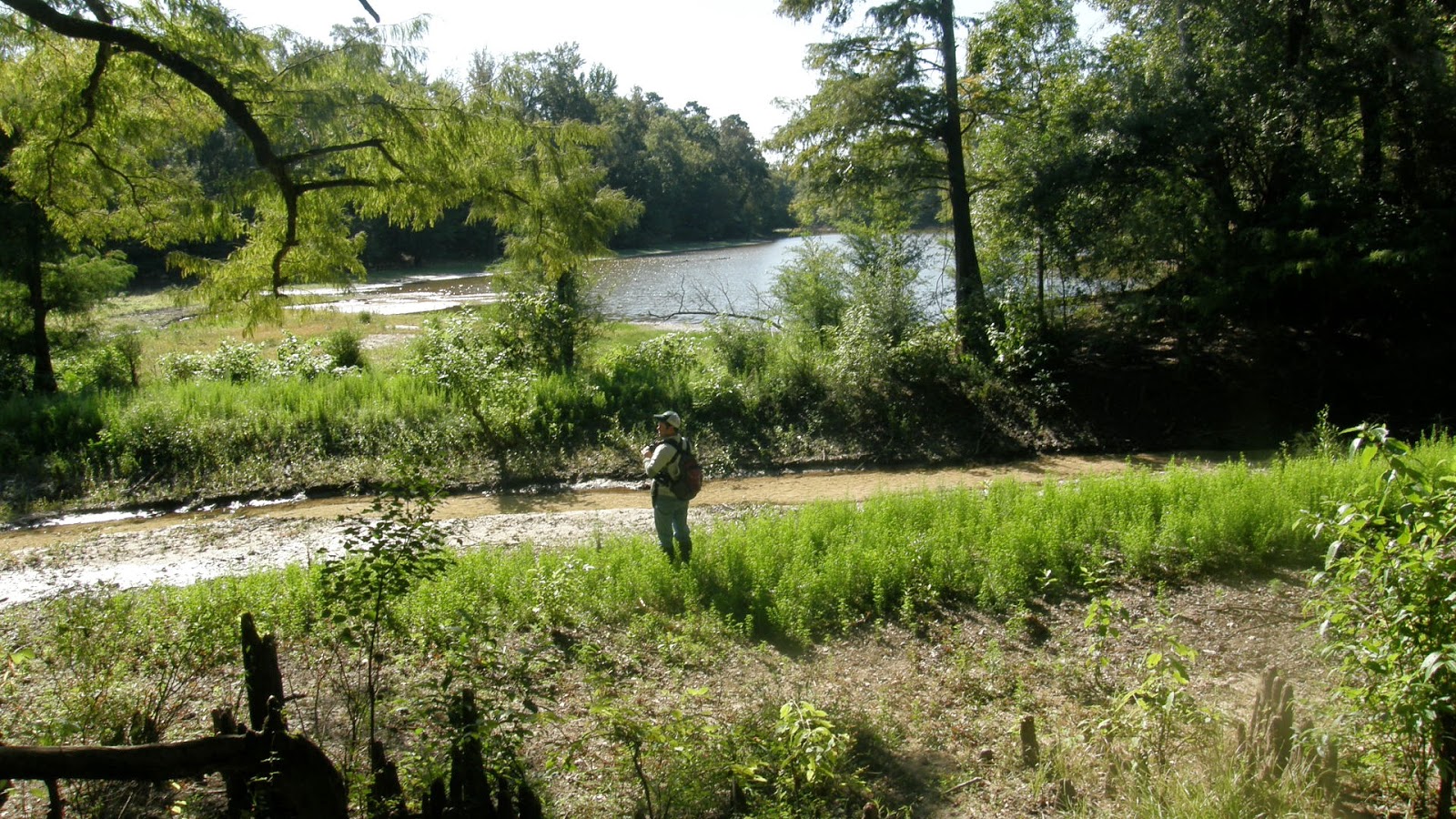
Returning to the west bank, we drove around some of the public roads until reaching McRae Dead River in the WMA.  McRae Dead River is a long, narrow oxbow, once in the Pascagoula River channel, and does connect to the river in high water.  Now the water is very, very low, allowing easy passage along its banks.


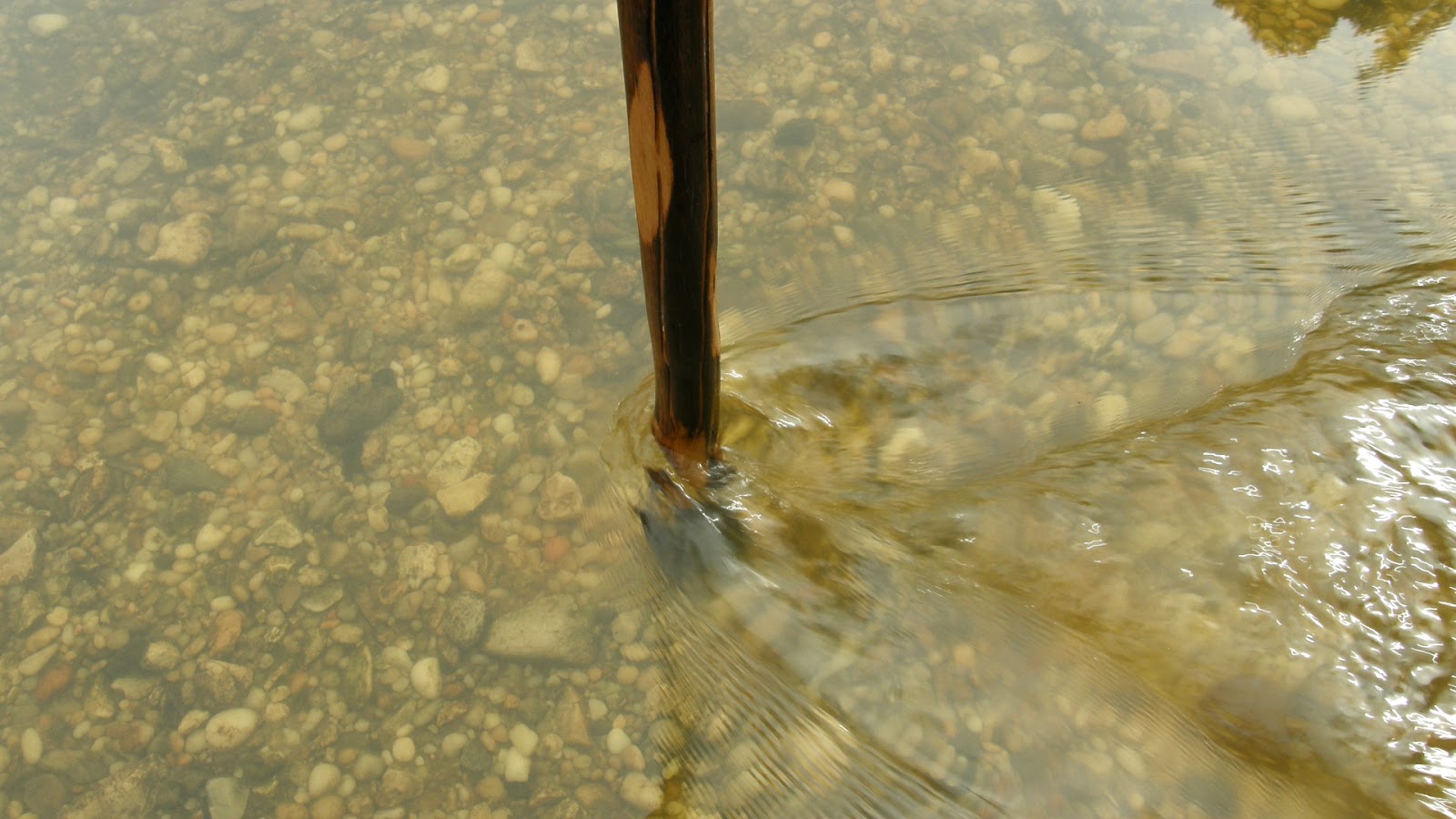
Brian crosses a cold, clear stream flowing into McRae Dead River. 

The water was low enough here to cross what is normally a shallow end of the oxbow, near a ruined beaver dam.

We took the opportunity to explore the surrounding forest.  It is generally youthful mixed bottomland, with a few widely-spaced older individuals, usually water oaks; and there is a nice grove of mature live oaks.  The forest is interspersed with wild tangles of blackberry, muscadine, and brush, that makes the going difficult.  Human activity is very obvious at the lake, in the form of the rotting hulks of two fiberglass boats and numerous cans and bottles littering the shoreline.  As far as potential IBWO habitat, I would rank the area around McRae Dead River rather low, much lower than the mixed forest to the north, around Hutson Lake.  I could find no signs of scaling on any of the living trees.  Finding that the forest grew progressively less promising the farther we progressed, we called it a day and turned around less than halfway around the lake.

Shagbark hickory. 

I think this is a Fowler's toad.  I hope someone more knowledgeable will correct me if I am wrong. 

The cypresses are ever so slightly shifting to their autumn dress. 

The lake, as well as the Pascagoula River itself, is very low.

Conclusions:  Big Swamp is, by our best reckoning, inaccessible save by boat.  Until we obtain kayaks, access to some of the most promising ivorybill habitat in the Pascagoula WMA will be limited mostly to the area around Hutson Lake, where there is still some areas that we have not explored.  Big Swamp, and Black Swamp further south, yet remain tantalizingly beyond our grasp, for now.


Wednesday, October 1, 2014

Close Survey: Beaverdam Creek, Black Creek Wilderness, 30 September 2014

IBWOH:  Chris Carlisle.

Summary:  I parked IBWO-1 at the trailhead near the General Jackson Interpretive Trail and began my hike at 7 a.m., not long after sunrise.  (Andrew Jackson apparently led his army through this area on his march to New Orleans in 1814.)  A clear dawn rapidly gave way to haze.  Temperatures were mild, though it was very muggy in the forest.  Over the next four hours, I hiked the Black Creek Wilderness Trail as it wound its way first upstream along Beaverdam Creek, then (crossing the creek via the Highway 29 bridge) downstream to where Beaverdam Creek joins Black Creek; then, a little farther on, to a small oxbow lake just south of Black Creek, in the bottoms between the creek and the piney ridges.  I began the hike back at 11:15, and arrived back at the trailhead at 1:20.  Much of the trail (now largely cleared, thanks to work crews) there winds through pine uplands, but there are many opportunities to explore the bottoms in and around both Beaverdam Creek and Black Creek, and I availed myself of several.

The forest was very still.  Biting insects were largely absent, and I did not have to use any repellent.  Bird life seemed a bit muted, even the blue jays.  I heard several pileated woodpeckers and flickers, and saw and heard red-bellied woodpeckers.  There were many thrushes in the woods, both wood thrush and hermit thrush -- likely migrants.  Small flycatchers were common, as were Carolina wrens and tufted titmice.  I saw one catbird.  The tanagers are gone.  Turkeys were vocal, and I flushed one from thick brush among the pines.

My focus was a search for sign:  scaling, of a type that could be consistent with that of ivorybills.  I did not find any.  There was, moreover, a dearth of scaling in general, save for on the many hurricane-killed pines, with one glaring exception.  I also found very few woodpecker cavities, which I found odd, considering the abundance of standing dead timber.

Typical scene at trailside. 

Living loblolly pine showing extensive scaling and excavation. 

The bark on the affected side is loose and easily sloughed off.  The bark on the opposite side is tight. 

I suspect Pileated and Red-bellied Woodpeckers.

Beaverdam Creek, from a high bluff on the west bank. 

A shallow stretch of Beaverdam Creek.   


Herroh. 


 Magnolia overlooking Black Creek.

I liked its shape and way of growth. 


Loblolly pines and white oaks crowd the bluffs and ridges overlooking Black Creek. 


Small oxbow. 


Typical pine snag along the trail. 

I discovered a hidden trail that leads to the confluence of Beaverdam Creek (foreground) and Black Creek.

On the return hike, I decided to attempt some cross-country orienteering, using my compass:


Luckily, it worked.

Conclusions:  A very enjoyable hike, tinged however with frustration and disappointment at not finding any sign of IBWO's.  While it is not "all about the IBWO," and the area is more than worthy of future hikes, I do not plan to return any time soon, at least not to that area of Black Creek Wilderness (I may return to the eastern edge later, if time permits).  If Campephilus principalis does indeed inhabit the Wilderness, it is likely only a pair, or maybe a lone individual.  And while, as contributor Fangsheath at the Ivory-bill Researchers Forum has (importantly) noted, "...the absence of such evidence should not be taken as absence of the ivory-bill" (referring to feeding sign), hunting for ivorybills in country where one can find no evidence, however promising the habitat, almost feels worse than fruitless.  

My companions and I have explored some of the most promising tracts on the periphery of the Pascagoula basin, and at points further in.  We have found no scaling or cavities that suggest the presence of ivorybills anywhere, save within the more immediate swamp forests of the Pascagoula and lower Leaf rivers; and only within the Pascagoula River Swamp lie bottomland forests that seem (to my mind) extensive enough to support one or more pairs of Ivorybills.

My fiancee Susanne has said more than once that I should focus my efforts on the Pascagoula.  Having ruled out the peripheral locales, I can no longer argue.  All roads in my search for the Ivory-billed Woodpecker in south Mississippi now lead to the Pascagoula River Swamp.


Sunday, September 28, 2014

Season of the IBWO

On 23 September, the first day of autumn, a cool front passed through South Mississippi, just a few days after our foray into Black Creek Wilderness.  Temperatures dropped into the low to mid-60's (Fahrenheit) at night, while daytime highs were in the 80's:  cool and pleasant, by Southern standards.  The past couple of days have seen the temperatures inching higher; but the word has been given.

Barring unforseen events, acts of God, etc., I will return to Black Creek Wilderness this Tuesday, 30 September, for a close survey of the western edge, around Beaverdam Creek.  Hopefully it will not be too hot.  I have already packed my rain poncho.

Early autumn is not the prime season of year for a search for ivorybills, but I am still largely in the scouting stage.  Other, much more seasoned searchers will be returning to the Southern swamp forests later, I imagine, when ivorybills are more vocal; and long after leaf-fall, when visibility is better.  Among them -- and I do not know who all will be in the field this season -- I look forward to reports from the Project Coyote team the most, who have been working methodically in Louisiana for years now.  I have learned much from their example, particularly with regard to feeding sign, which has been invaluable to me in my own nascent methods.  I hope the coming season is successful beyond their expectations.

My own efforts in the coming months may be a bit more sparse, as balancing work and family during the holiday season impact my time afield.  (For the record, the time and expense I take to conduct my search for the Ivorybill -- including, I should add, that of my companions Brian Carlisle and Richard Ezell -- are solely our responsibility, being an independent search group.  My job requires me to work 48-50 hours per week, and both Richard and Brian work in the offshore oil industry for two weeks at a time.)  During October and November -- if Black Creek Wilderness does not compel me to return -- I plan to begin forays farther down the Pascagoula River Swamp:  specifically, in the wide area between Sandy Wash Bend and Bull Bay Bend, as well as farther down, in Black Swamp.  I have been able to ascertain a walkable route directly into the heart of the Swamp -- walkable, that is, until the winter rains begin to make their impact, and the sloughs and basins fill with dark water.  I am still saving for a kayak, and hope to be able to purchase one come December, when travel in the swamp forest will be all but impossible in many areas without one.

Recently, thanks to Project Coyote, I read Cornell's "Final Report" from their 2006-2007 Ivory-billed Woodpecker Surveys and Equipment Loan Program.  (I have added the link to the list on the right of this page.)  Among the wealth of information within its pages, there is this -- their description of the Pascagoula River Swamp, and its potential as IBWO habitat:

In the southern portion of the Pascagoula WMA, in the fork between Big Black Creek and the Pascagoula River, a roughly 2,400 ha tract of old bottomland hardwood forest is located that is locally known as Big Swamp.  The last cut in the tract was a light and selective cut in the late 1950's.  Today numerous big oaks and sweetgums dominate the forest.  The Pascagoula was at the periphery of the pathway of Hurricane Katrina in 2005 and was moderately damaged by the hurricane.  Large trees were toppled or snapped in a patchy pattern.  Areas of tall blackberry briars occur frequently in the area, making explorations on foot during daytime somewhat difficult and return hikes after dark arduous.  Fourteen km north of the Big Swamp, between Bull Bay Bend and Sandy Wash Bend, hardwood forests are less mature, but still include many sizable trees; pines are frequent in higher areas with sandy soils.  Many pines were killed or damaged by the hurricane and are extensively being scaled by Pileated and Hairy woodpeckers.  The area between Bull Bay Bend and the Big Swamp is probably also good habitat, but has not yet been explored except for a scouting float on Black Creek.  Ward Bayou WMA in the south of the Pascagoula basin is mostly younger and lower forest.  The central Pascagoula basin is excellent habitat and ranks second only to Congaree National Park as an area of high quality hardwood habitat for IBWOs.  [p.26.] (Emphasis mine.)

I have been studying my maps of this area for some time, informed by the day trips I took this past summer to Red Swamp with Richard Ezell, and to Goff Basin with Brian Carlisle.  The Cornell article has helped me make up my mind to put in some time there this fall.

It is raining outside as I type this, and actually looks a bit wintry.  The summer birds are already leaving.  The kingbirds are gone, and the ruby-throated hummingbirds are staying only a few days before moving on.  Brian emailed me a photo he took out on his oil rig on the Gulf of Mexico:

  Prothonotary warbler.  (Photo:  Brian Carlisle)

The woods may be quieter when I walk them again.  They will definitely be much quieter over the next six months or so; but maybe there will be other things I will hear, that I have not heard before.


Friday, September 19, 2014

Expedition: The Slope Forest: Black Creek Wilderness, 18 September 2014

IBWOH's:  Brian Carlisle, Christopher Carlisle

Summary:  A planned two-day camping trip in the 5,000+ acre Black Creek Wilderness was shortened to a day hike due to extenuating circumstances in our households.  Black Creek Trail is about 40 miles long, extending throughout the southern section of the DeSoto National Forest, but its length within the Wilderness, which lies within the greater National Forest, is about ten miles.  In the end, it felt like 40.

Black Creek Wilderness, established in 1984, can be perhaps divided into three parts, the largest being pine plantation in the southern two-thirds.  Along the east-northeast boundary, and following the line of Black Creek, is Red Hills area, where the pine plantation drops down to the creek in a series of high, steep (sometimes almost sheer) wooded bluffs.  This slope forest includes extensive stands of mixed pine, beech, silver maple, sweetbay, and bigleaf magnolia, among other species; and I was reminded of a similar forest type, in the wooded ridges leading down into the swamp of the much smaller Leaf Wilderness farther east.  Along the north and north-western boundary of the Wilderness grows a somewhat more extensive mixed forest, with fully mature American magnolia (many very tall), sweet gum, and white oak in great numbers, along with tulip poplar, river birch, water oak, and the others mentioned.  Dogwood and American holly are common understory species throughout the hardwood forest.  Beaverdam Creek, a very large and strong stream, flows north into Black Creek, and the latter forest type extends south from Black Creek to envelop it.  At least one wooded oxbow (which we were too tired to explore), along with some fairly extensive swamp forest, lies near Beaverdam Creek.  Black Creek Wilderness trail winds some 10 miles through all three habitat types.

There has been, as far as I could tell, no fire activity of substance in the Wilderness for many years.  As a result, the pine forest is mostly shortleaf/loblolly, as longleaf requires periodic fire for propagation and general forest health.  (There may be stands of longleaf farther south in the Wilderness, more distant from the trail.)  However, the impact of Hurricane Katrina, in August 2005, can still be seen in the form of enormous pine boles lying across the trail in many places.  They have lain there so long that the bark has long since sloughed off, leaving them slick and green with moss.  The trail itself is in many places difficult to navigate, especially in the remote north of the Wilderness, making the going treacherous.  I was able to pick the path out at times, but it was more often than not my brother Brian who led the way, spotting the green-stained white diamond markers when the trail was little more than an opening on the forest floor.*

The birds were quiet.  Hooded warblers, Eastern phoebes, cardinals, summer tanagers, ruby-throated hummingbirds, Carolina chickadees, and tufted titmice comprised most of the species we encountered.  We surprised a flock of wild turkeys on the trail, and heard others clucking out in the forest farther on.  Pileateds laughed at us on and off all day long, and I believe I heard a red-bellied woodpecker once; but we never saw any of them, and we did not see or hear any other species of woodpeckers.  Nest cavities were mostly restricted to pines, and were not particularly common.  Totem trees (dead trees conspicuously pulverized by woodpeckers) were easily found, especially in the mixed forest near the creeks.

Staging our trucks at either end of the trail, we began our hike shortly after 7 a.m., and did not finish until after 5 p.m.  Well before Beaverdam Creek, I began to feel the effects of heat exhaustion, as the temperatures were in the low 90's, along with high humidity, no wind, and no relief from the sun among the pines.  This slowed our progress considerably, as I knew the only remedy was to stop and allow my body to cool itself.  Some relief came with an overcast sky around noon, keeping temps from rising any farther, and I began to feel better, save for the intolerable pull of my daypack on my shoulders.  But as I found new strength, Brian -- who seldom ever complains on the trail -- began to admit to fatigue.  We plunged ahead, bagging our cameras, weary of the straps dragging on our necks.  Luckily, we were largely untroubled by biting insects.  Near the trail's end, it follows Highway 29 north for about a mile; and there we were caught in a heavy downpour.  Brian had his rain poncho, but mine was in my overnight bag back at home; so while he was drenched, I was doubly so.  Luckily, a Forest Service truck came by, and a kindly older employee ferried us through the storm back to Brian's truck.

My drive home was over an hour long.  I was a little chilly, sitting there in my wet clothes, so I kept the heat on in my truck for much of the drive.  When I got home and got out, I was immediately chilled, and was shivering uncontrollably by the time I made it inside our house.  I quickly got into a hot bath, but was still cold afterwards; and as I write this, a day later, I am still running a low grade fever.  Apparently, one can get hypothermia in the summer, even in Mississippi.


Beautyberry, abundant in the Wilderness. 


Modest scaling to a living shortleaf or loblolly pine. 


Bigleaf magnolia Magnolia macrophyllu (center) and sweet gum (top) 


Southern black racer Colubor constrictor priapus, the only reptile we encountered. 

 Cavities in a living pine.  I suspect Pileateds, though the gently upward angle of the lowest and largest cavity is odd.

Sandbar on Black Creek, near the Red Hills. 

A nice gravel bar. 

The current was strong there.

Conclusions:  I have never been in a forest with more types of trees than that found in Black Creek Wilderness.  I found no scaling or cavities that could be considered diagnostic of Ivory-bill feeding or nesting activity, but the maturity and variety of the forest, along with its remoteness (we had no bars on our cell phones for most of the day), lead me to believe the Wilderness could support at least one pair of Ivory-bills.  However, while both the Red Hills and the Beaverdam Creek areas are worthy of close study, I only plan on returning to the Beaverdam Creek area, there to investigate the hidden oxbow; but I will not return until cooler temperatures in the fall.  The Southern summer has, in its last days of 2014, finally gotten the better of me.

*It should be noted for prospective visitors to this section of Black Creek Trail that, near Beaverdam Creek, we encountered a team of Hispanic men, workers clearing the trail of downed timber and overhanging growth.  These men were armed only with axes and machetes, and a wheelbarrow full of ice and bottled water.  The rest of the trail, to Highway 29, was clear and easy to navigate, thank goodness.  I suspect they will have the trail completely clear of debris in time for fall turkey season.


Tuesday, September 16, 2014

Encounter on Black Creek, 1978

     "In 1978, ornithologists Ronald Sauey and Charles Luthin* visited southeast Mississippi to float Black Creek, a meandering blackwater stream that flows through DeSoto National Forest, eventually joining the Pascagoula River in extensive swamp forest.  On the second day of their float they heard what Sauey later wrote 'sounded every bit like the historic Ivory-bill recording of Allen and Kellogg.' The following is from Sauey's letter of February 2, 1978, to me:

     'On our second day of boating on the creek (floating without motor to be as quiet as possible) we found an amazing congregation of mixed species -- Brewer's [blackbird, Euphagus cyanocephalus], Rusty [blackbird, Euphagus carolinus], Redwings [red-winged blackbird], Orange-crowneds [warbler, Vermivora celata], Yellow-rumpeds [warbler, Dendroica coronata], etc., etc., etc., and dozens of woodpeckers.  We were probably moored... for about an hour when a couple of Pileateds flew in... and started up a ruckus.  Shortly after, we heard a very loud series of tappings from farther down the river and then a number of distinct musical calls, given repeatedly on the same pitch and reminding us both of a nuthatch [Sitta sp.], only louder and not as nasal.  The calls stopped, and then were repeated again, only closer this time to us.  The call sounded even less like a nuthatch the second time, being fuller and more resonant, and we both looked at each other in disbelief -- was it an Ivory-bill?... we never saw the creature making the call.'

     "Sauey's report, combined with reports of others, the vastness of the Pascagoula Swamp, and the history of ivory-billed woodpecker specimens collected in the area in the late 1800s all suggest that the swamp forests of southeast Mississippi hold promise for ivory-bills."

-- Jackson, Jerome A.  In Search of the Ivory-billed Woodpecker (Washington:  Smithsonian Books, 2004):  178-179.

*Late co-founder of the International Crane Foundation, and executive director of the Natural Resources Foundation of Wisconsin, repectively (my note).


Friday, September 12, 2014

Love Those Blue Jays. Not.

By now most Ivorybill searchers and enthusiasts are aware of the impressive ability of the Blue Jay to make all kinds of interesting audible reasons for giving one wide-eyed pause while in the field.  On my latest foray into the Pascagoula River Swamp, I captured some rather uncanny "tootling" noises they were making high in some hardwoods, which had me standing like a stone pillar for a few minutes before I saw them gliding through the treetops and bobbing at one another from upper branches.